Guide: What should you take with you?
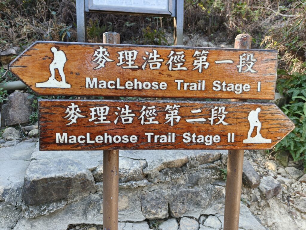
How do you get to MacLehose Trail, section 2?
What can you expect for the hiking part of the trail?
What to do after the hike?
Years ago, I remember someone told me that she loved going to Hong Kong because of all the hikes that you can enjoy there—especially on the different islands. I remember thinking that hiking in Hong Kong sounded amazing. But I also remember thinking that it sounded impossible. How would I find the hikes and then make time to do them?
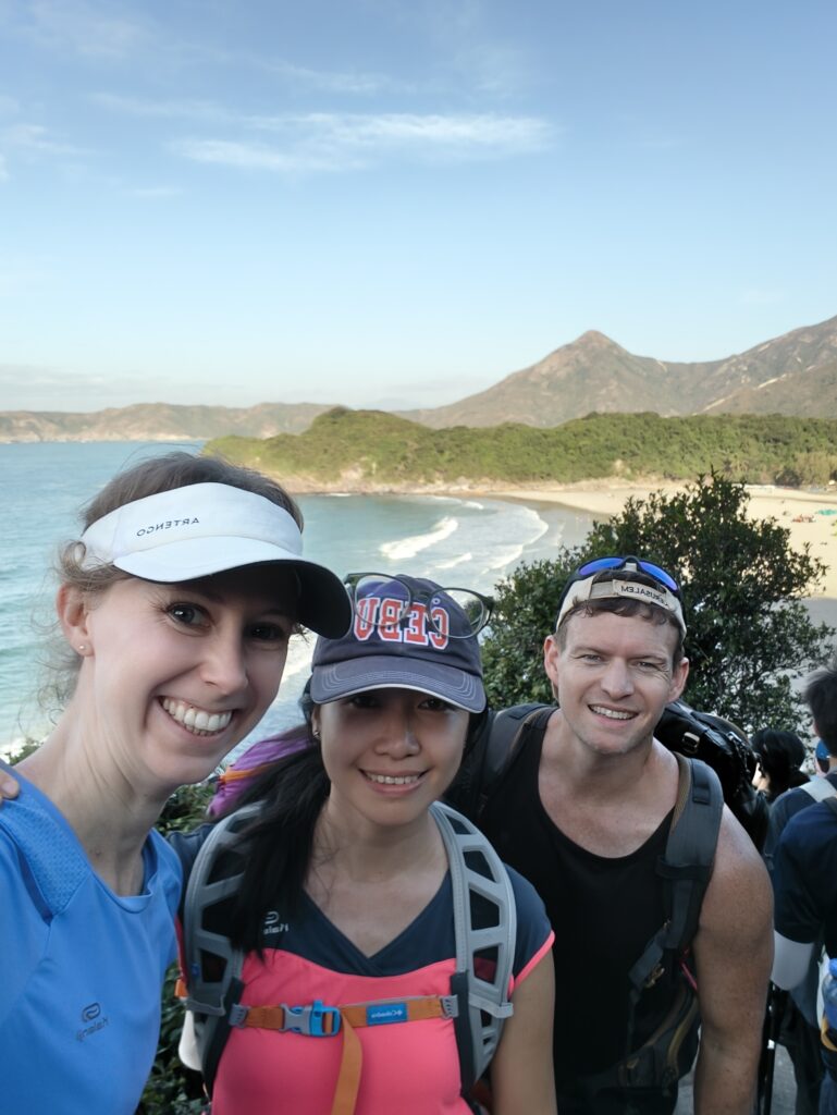
Now that I live in Guangzhou, Hong Kong is pretty accessible, but it’s still hard to find time to go hiking, and I still have a hard time knowing how to manage Hong Kong. Thankfully, I have friends who are more familiar with Hong Kong, and I will share our trip with you so that if you like, you can also hike this incredible trail. And if hiking isn’t your thing, you can just enjoy my pictures as I share our adventures! The trail is called the MacLehose Trail (麦里浩径, mai li hao jing), and this time we did section 2 which was extremely beautiful!
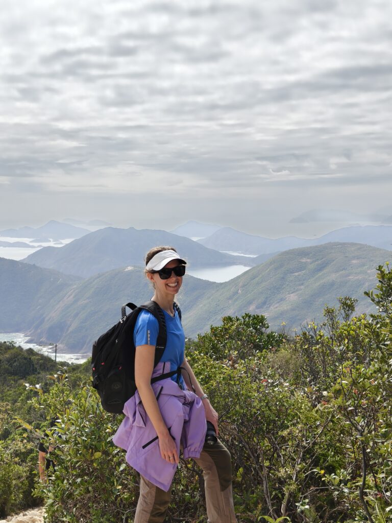
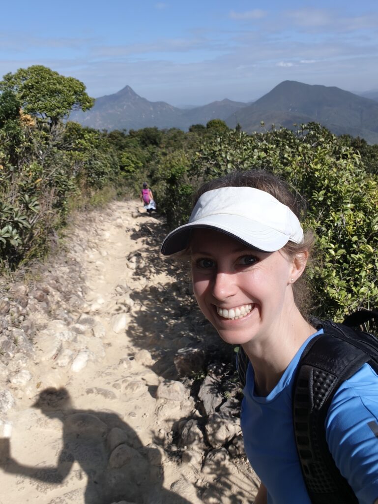
First, let’s look at what you should take with you? Definitely passport or ID card (HK pass for Chinese people), lunch, and lots of water. I took about 3L and Jeff and Jaye each had closer to 4L of liquid. I took mostly water and one bottle of Piccari Sweat (similar to Gatorade). Snacks (especially nuts!). Sunscreen—the sun was strong. Clothes for the next day since we planned to stay the night. My bag was a bit heavy! And I was hoping that my neck would be ok since I’d had back problems for the past couple of months. Tying the straps from my bag around my waist definitely helped to keep the wait closer to me and balance things out (or if your bag has straps for that, that would be even better!).
Next, how do you get to MacLehose Trail, section 2? For me, knowing where to start is probably the hardest part. I’ll start you off in Shenzhen. We took the train to Luohu 罗湖 (Shenzhen station) and arrived at about 8:15 or 8:30.
That meant that I had to leave my house before it got dark! But the surprising thing was that I saw some stars. The sky was quite clear, and even though I live on a college campus in the middle of the city, I was thrilled to look up and see stars.
Sorry, I digress.
We went through customs at the Luohu port and then got on the subway right there. Jeff and I had subway cards and Jaye (who is Chinese) could use a QR code. Subway cards are the easiest way to manage things in HK since most places don’t accept mainland WeChat or Alipay. Cash also works and there are ATMs at that port.
We took the train to 大学站 (Daxue zhan, University station). Then we went out of exit B. There are also bathrooms here! The next stage was a bit tricky. We needed a taxi to get to the starting point of the trail. Unfortunately, since this was Saturday, the taxi line was super long, and there weren’t very many taxis. We saw another couple that were looking for someone to share a taxi, but since we had three people, that didn’t seem like it would work. We went to the back of the line and Jaye tried to order a taxi online and then also tried to get an Uber. Nothing seemed to be working. We were standing in line for the green taxis, but I looked behind us and saw that there was almost no one in line at the red taxi line and there were several taxis waiting.
“Do you think we could take a red taxi?” I asked.
“Let me go ask,” Jaye said.
I waited in our green taxi line so I could keep our spot if the red taxi didn’t work out. A moment later, Jaye waved me over. “He will take us!” Thrilled, we got into the taxi and settled into the hour long ride.
“Why didn’t you take the green taxi?” The driver asked in Cantonese (Jaye translated for me). “It’s 40 HK dollars cheaper.”
“Ahh, that’s why the green line was so long,” I said, as we realized what had happened.
But we were all satisfied with our decision. We had a long hike ahead of us, and we wanted to finish it before it got dark.
The destination for the taxi and the starting point of our hike was 万宜水库东坝[公交站] (wan yi shuiku dong ba [gongjiaozhan]) Although since most of the drivers only speak Cantonese, knowing how to pronounce the words in Mandarin is not very helpful. But they can read it.
The taxi was around $265 total, so it wasn’t cheap. Sharing the taxi between 3-4 friends is ideal. The ride was going well, and I was happy to not have to carry my heavy backpack for now.
We ran into problems as we got closer to the start of the trail. Lots of people were walking, and we realized later that this section was probably MacLehose Trail, section 1. After we had been stopped and waiting for a while, the driver told us that it was because up ahead there was a section of road where only one car could drive at a time. So our side was blocked while the cars from the other side drove through.
Our driver told us that it would take 40 minutes by car, but if we walked, it would only take about 30 minutes. We later realized that this was completely inaccurate. It would have taken a lot longer than that to walk. We debated about whether or not we should get out and walk, and several cars ahead of us did turn around as the occupants got out to walk. But I figured it was surely getting close to our side’s turn, and I was hoping that even if we didn’t get through, it would be great to get one more push forward before we got out. So we waited.
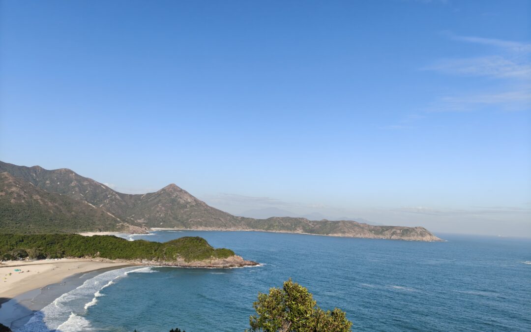
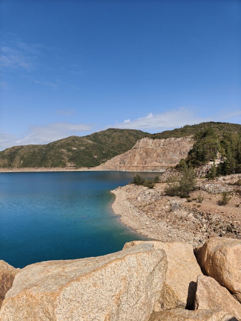
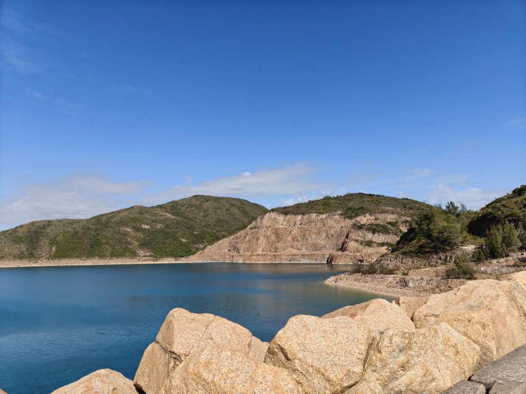
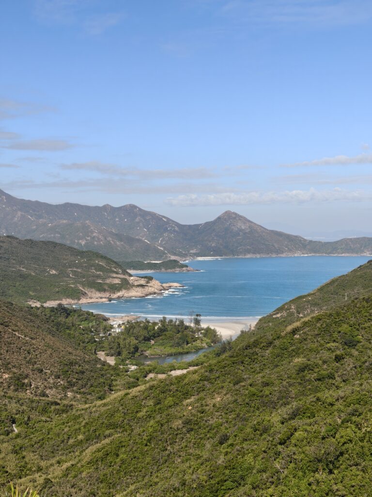
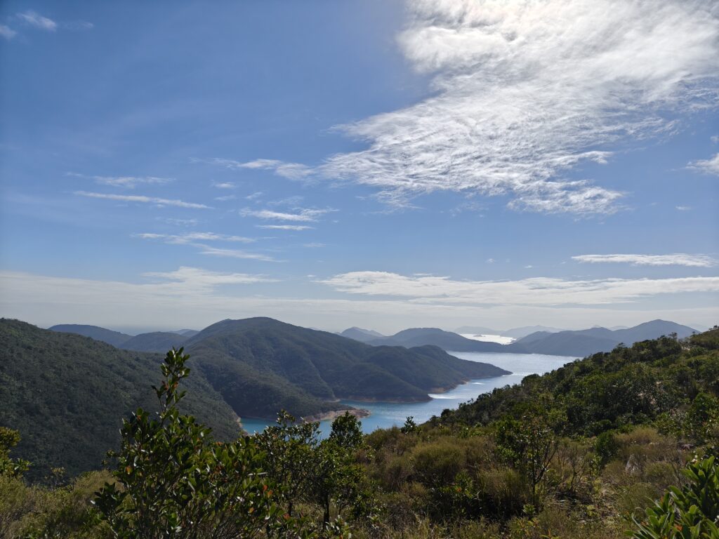
A few moments later, we started moving, and we all cheered. In fact, we found out that we were quite close to the front, and even though our driver was going pretty slowly (I think he might have wanted to turn around), we made it through. I’m glad we waited because the road still had about 5 km, and it was mostly a gradual incline. But the views were beautiful, and I was very happy to look out of the window at the incredibly blue water with the mountains all around the cove.
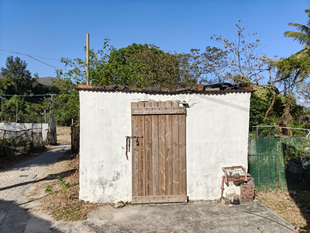
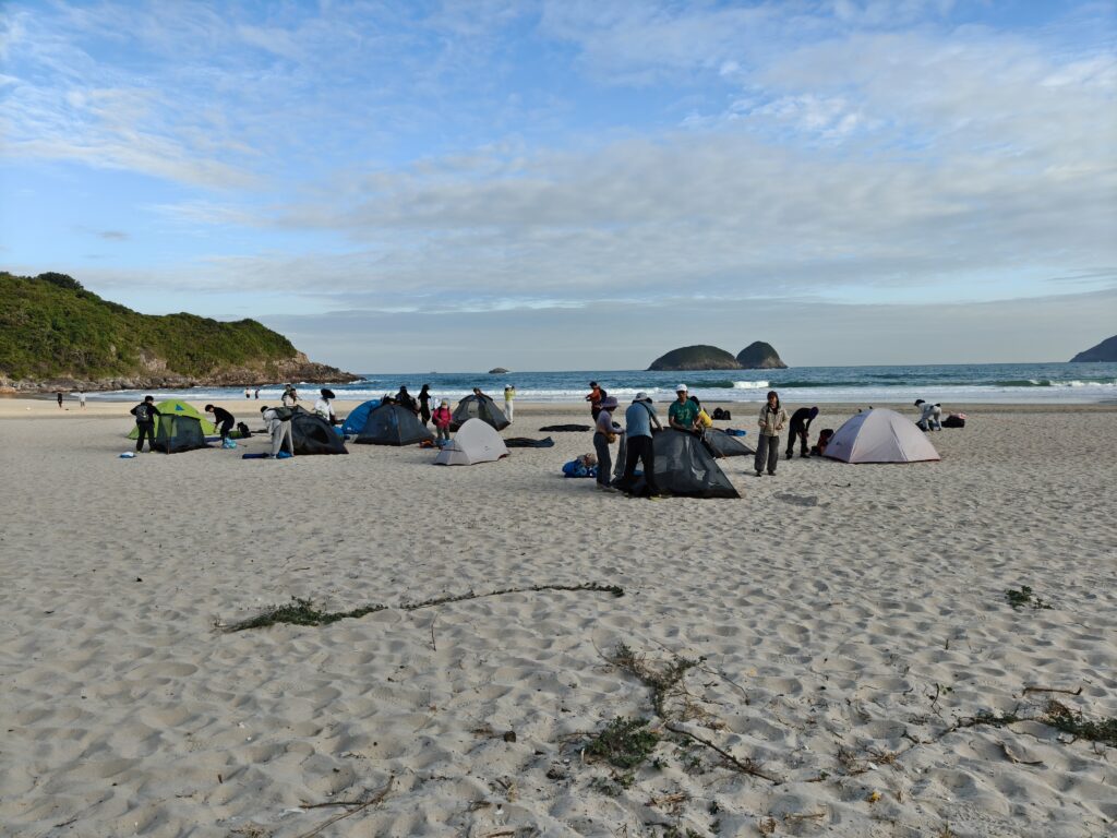
Not long after this, we got to the start of the trail. There was a side trail that we could have done to look at a spot that had a picture from the 500 bill HK dollar. This area was quite crowded, however, so we decided to skip that section. Plus, by now it was nearly 11 a.m., and we still had our entire hike to go.
After a short break (there were also bathrooms here, but since there were so many people, the line looked pretty long), we started out on the trail. I was relieved that most people didn’t seem to be hiking up this part of the trail.

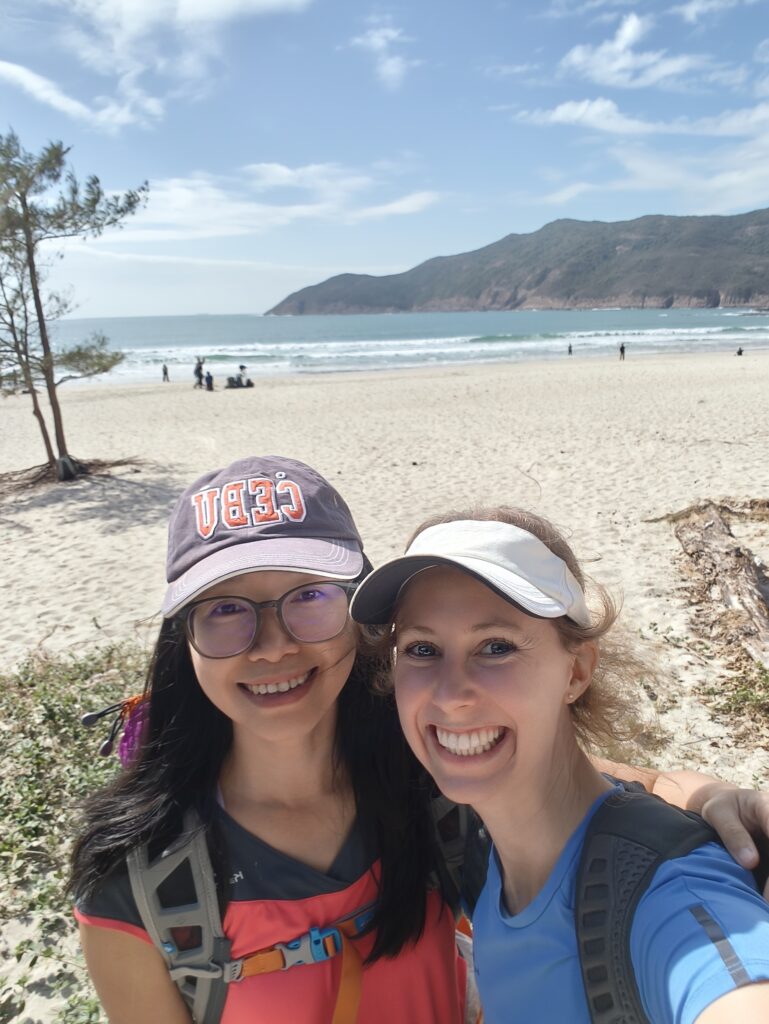
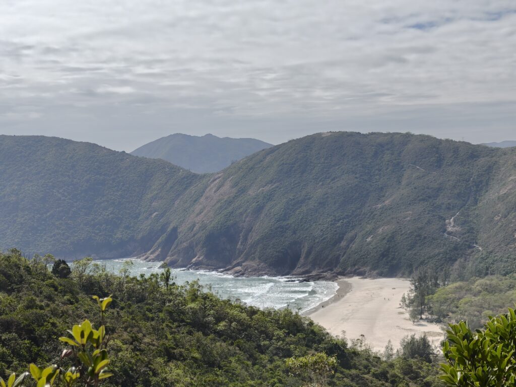
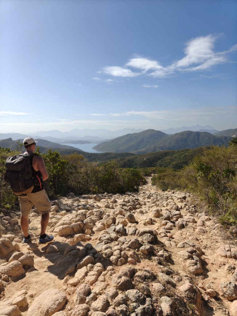
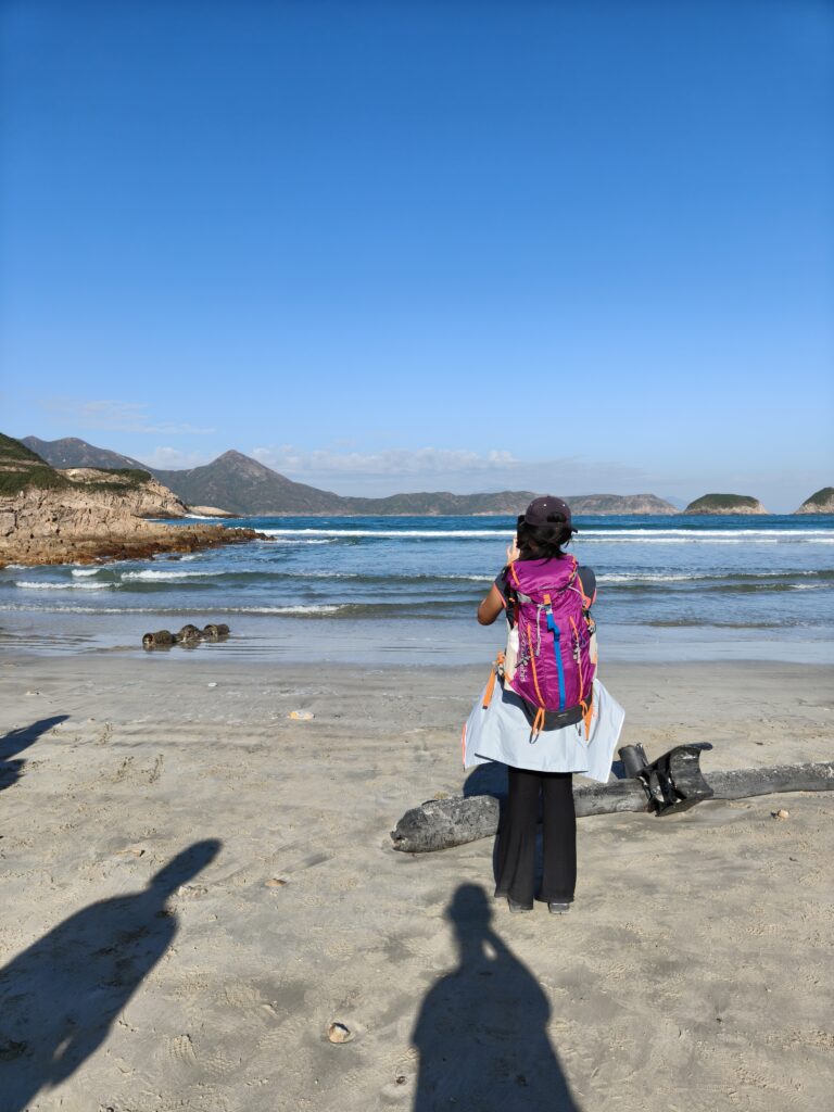
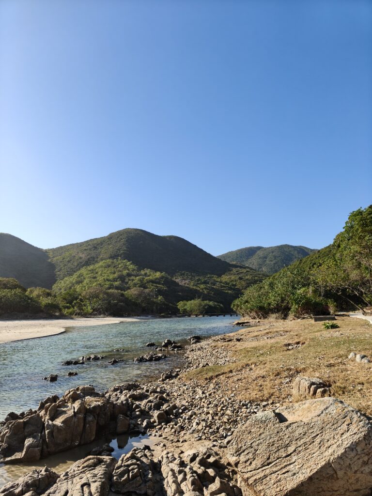
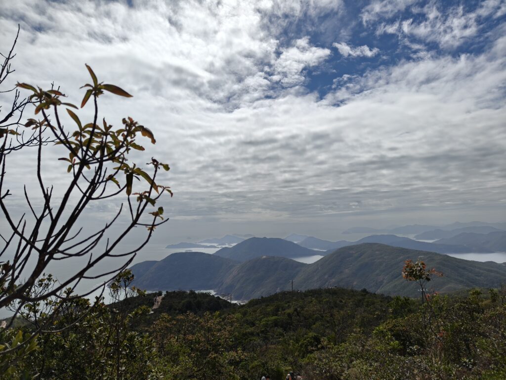
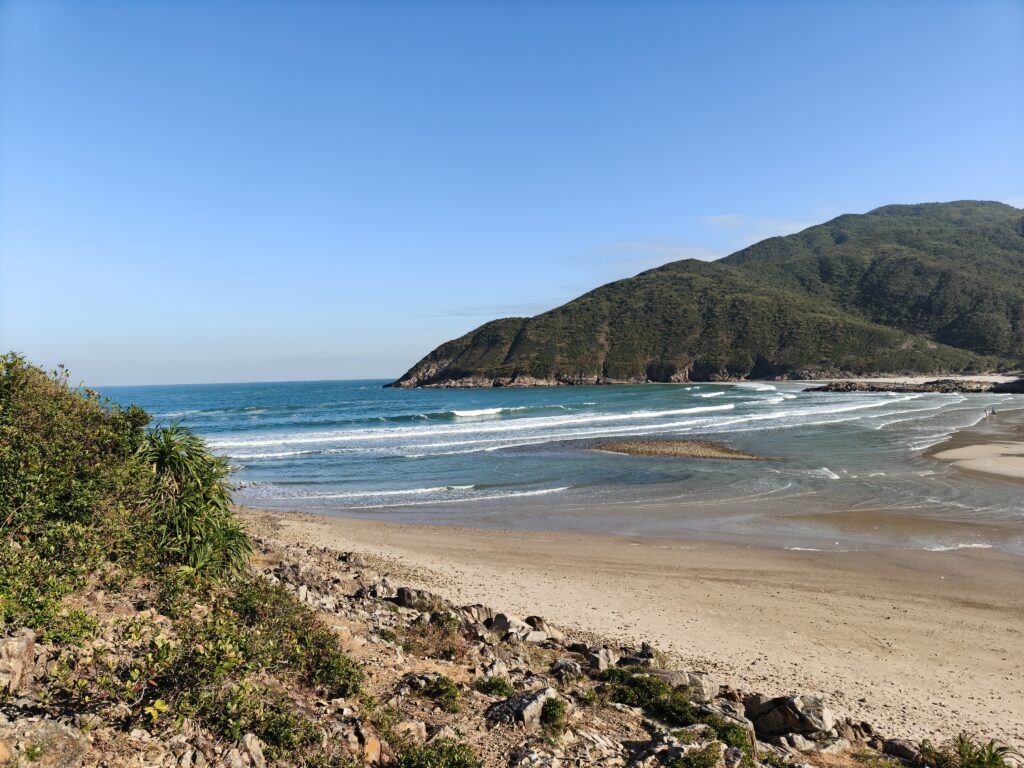
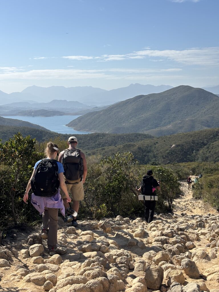
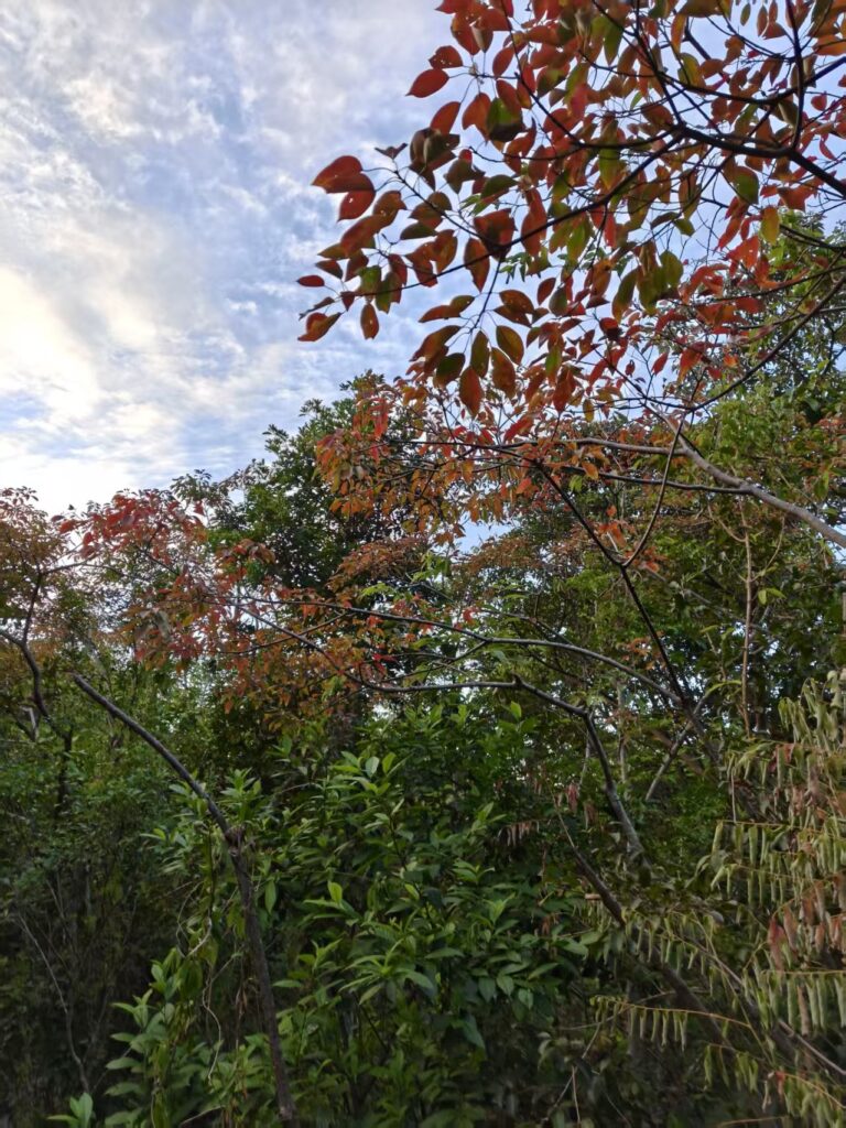
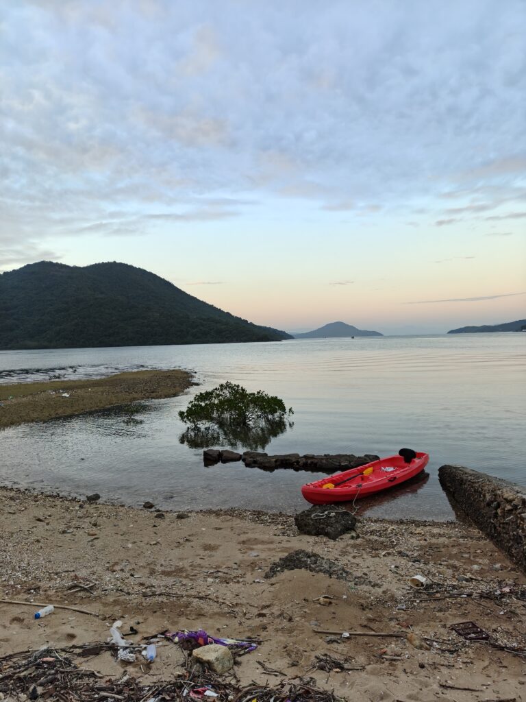
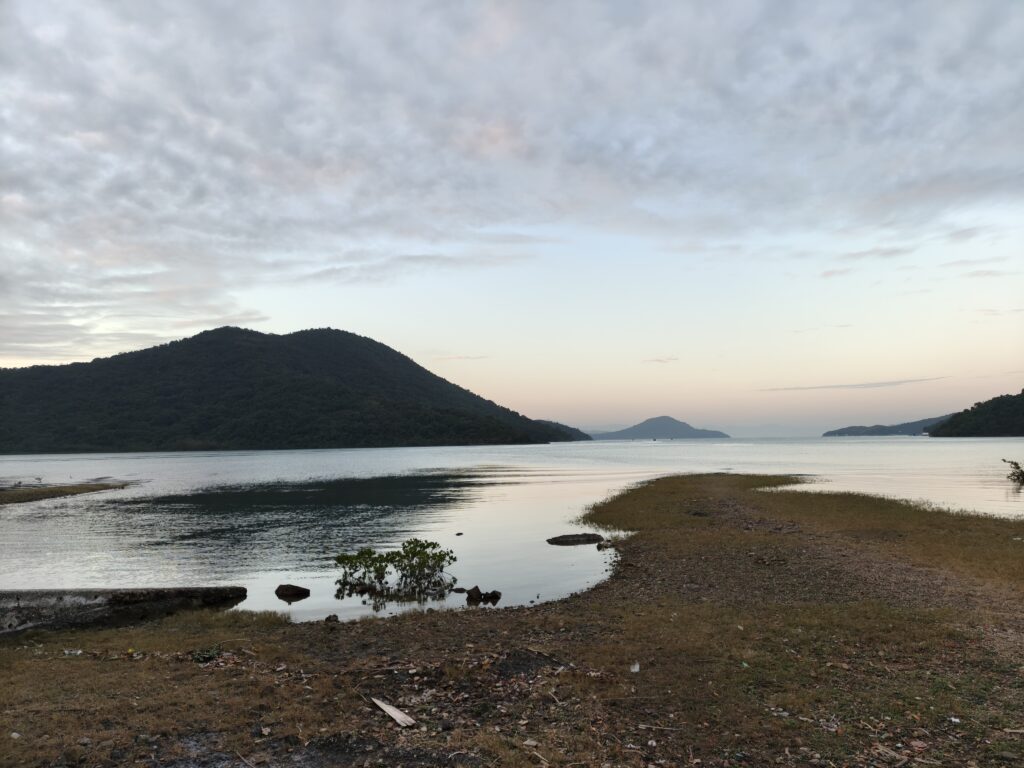
So now, what can you expect for the hiking part of the trail? We started out going up, but we also had some incredible views right from the beginning. This first part had a bit of a hill and then we went down to a beach. Actually, Jaye told us that this first section was the end of section 1. Oh well, we did some bonus kilometers. The beach was beautiful, and we enjoyed the view before heading off on the next section.
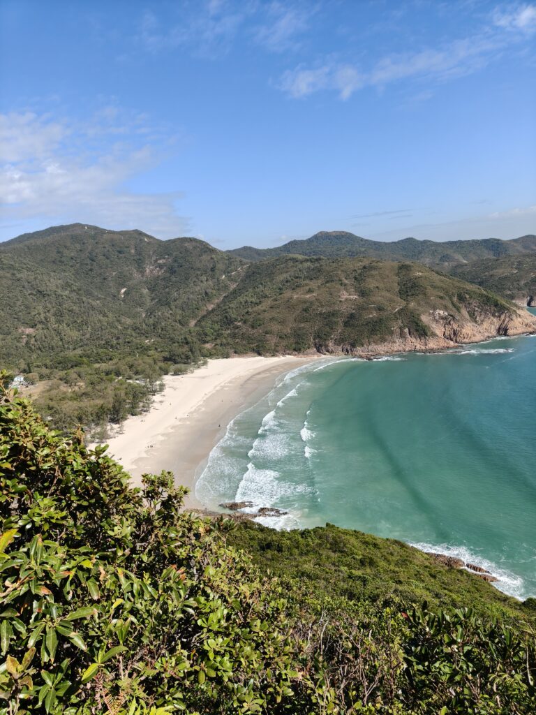

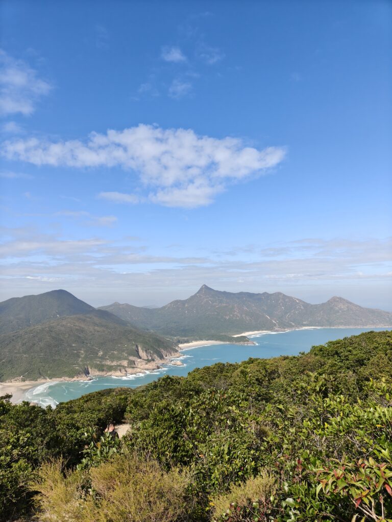
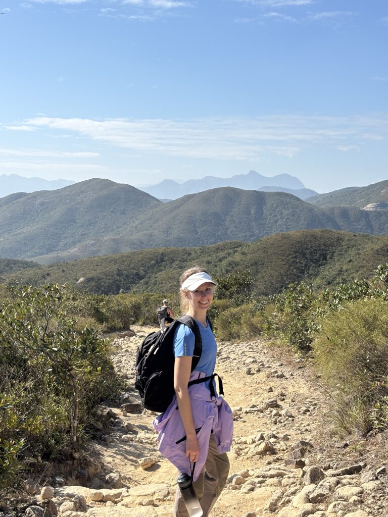
This section (section 2 is about 13.5 km. total) after the beach was quite challenging. We were carrying almost all of our water and lunch at this point, so our bags were heavy, and we went up and up and up until we were at one of the peaks. Toward the beginning, we could look back at the beach that we had just visited, and we marveled at how high we had come.
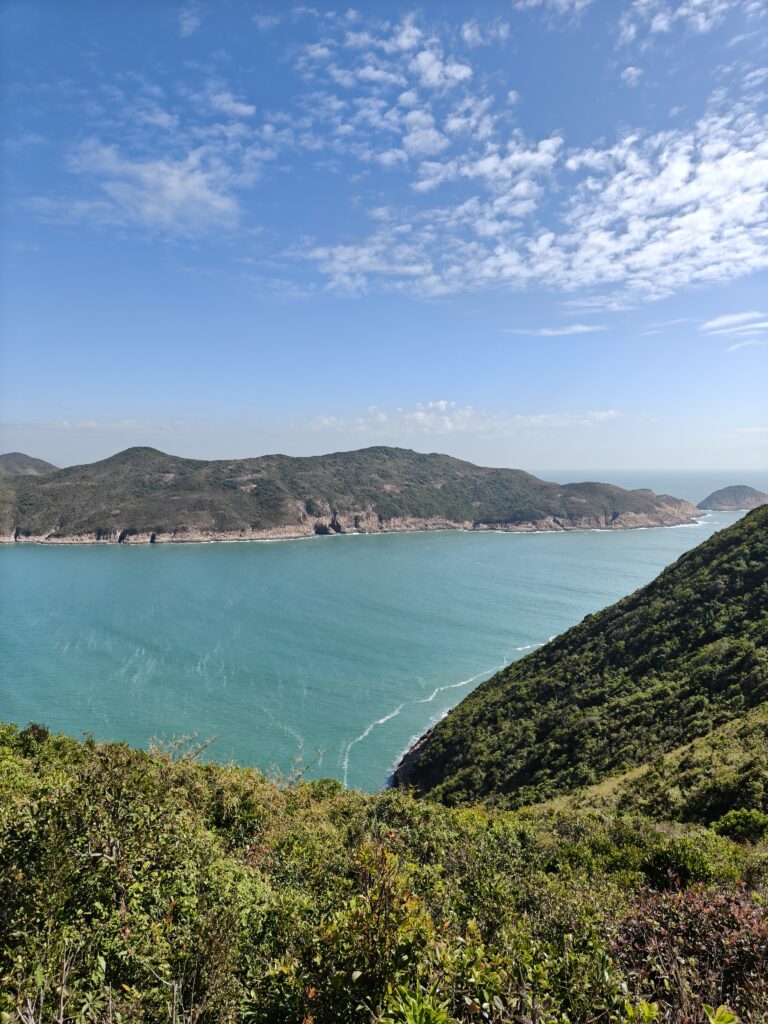
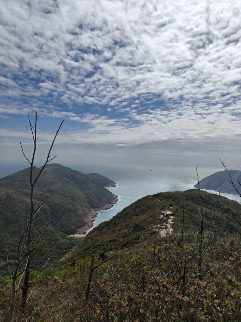
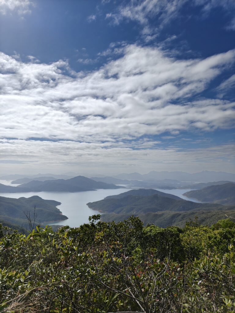
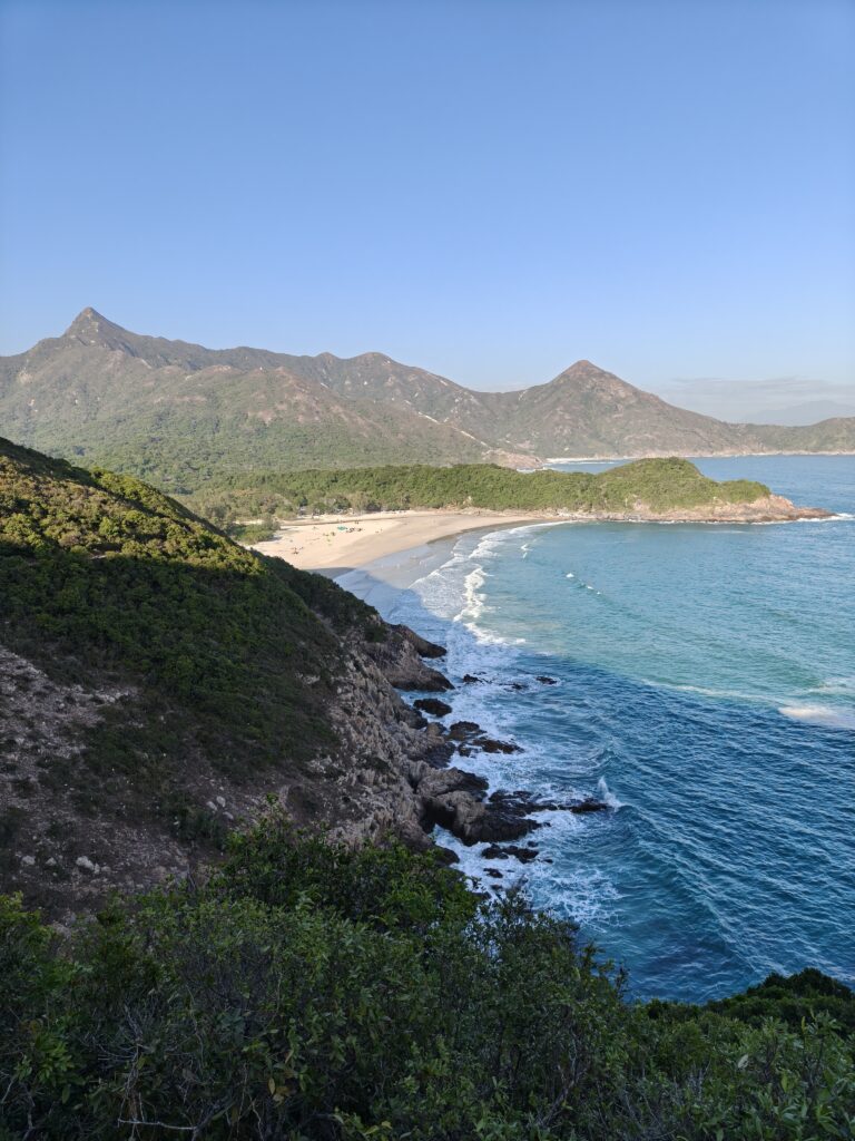
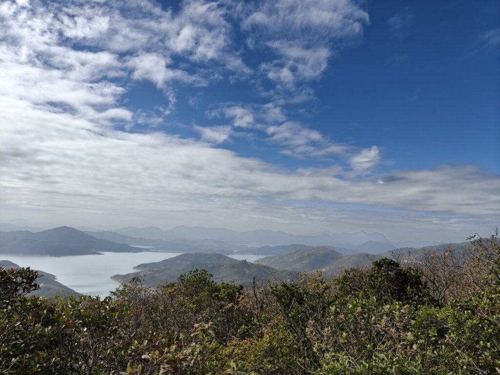
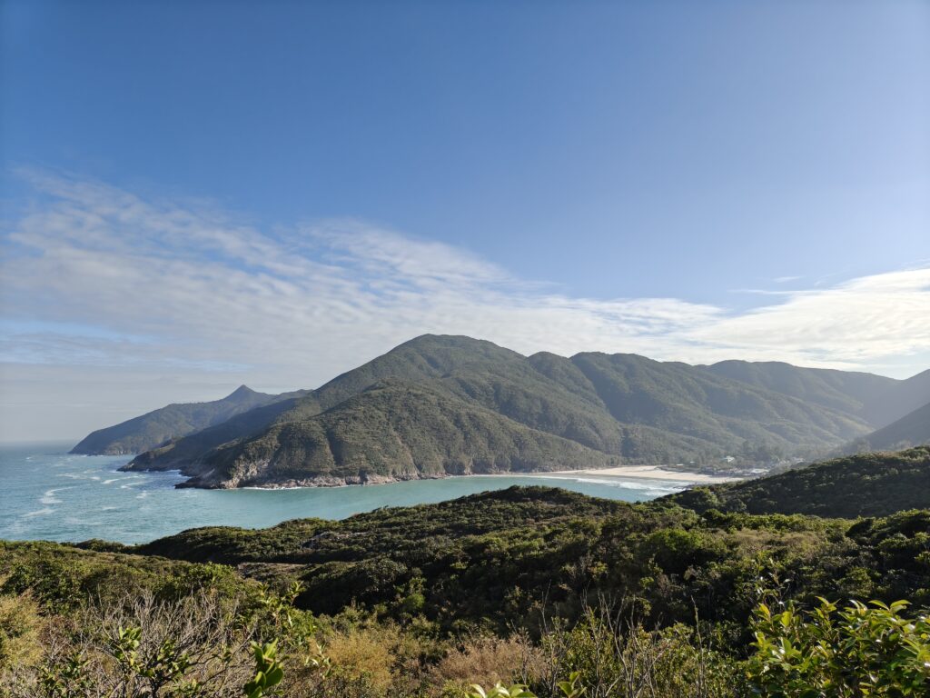
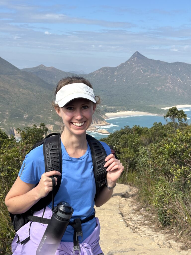
We reached the first peak and stopped to rest for a bit. The view was incredible as we looked out over the coves and enjoyed seeing so many mountains off in the distance. The city of HK felt like a distant dream at this point. There were a few people along the trail, but I didn’t feel overwhelmed by the number of people. I think seeing the crowds at the beginning had helped to adjust my expectations, so encountering a few people didn’t bother me.
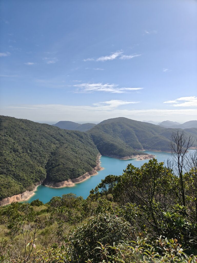
Plus, the weather was perfect. Even now at the end of November, the weather was amazing and even a bit on the warm side. The sky was clear and we could enjoy the view in so many directions there at the peak.
Now, as I think back on this hike and the incredible weather, I’m struck by how beautiful it was. But at the time, I took it for granted. Of course it would be beautiful weather for our hike. It was autumn, and in this area, that’s usually the best season. But nothing is guaranteed. Today, just a few days later, is drippy and miserable. Just last week, I posted about our hike in Sichuan and how incredibly happy and thankful I was when the sun came out and we could finally see the blue sky. And now when I had a perfectly blue sky, I didn’t even think to thank and praise the One who gave me that blue sky. I am so quick to forget and so slow to recognize my many blessings. So now, I praise God for giving us beautiful weather on that hike. It was wonderful to be able to enjoy such a great view!
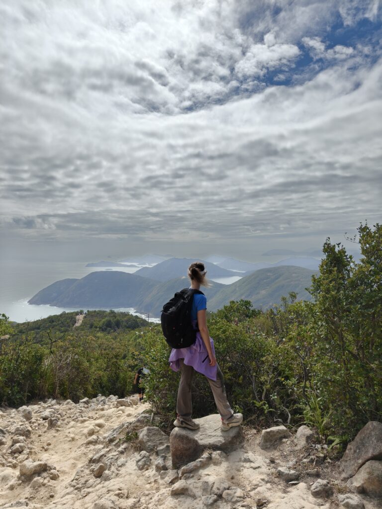
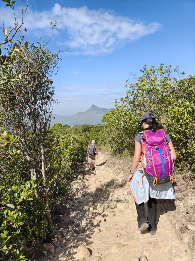
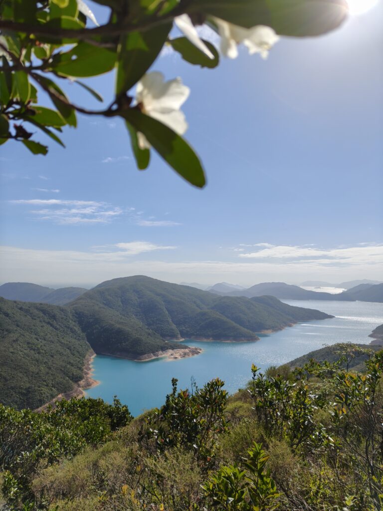
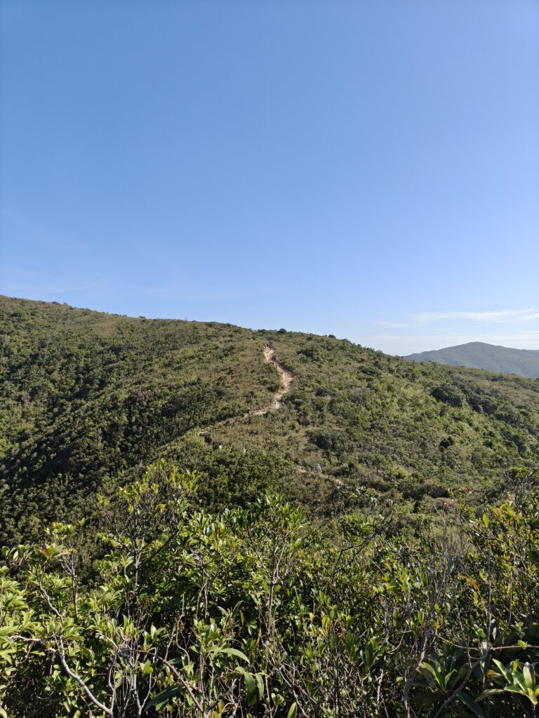
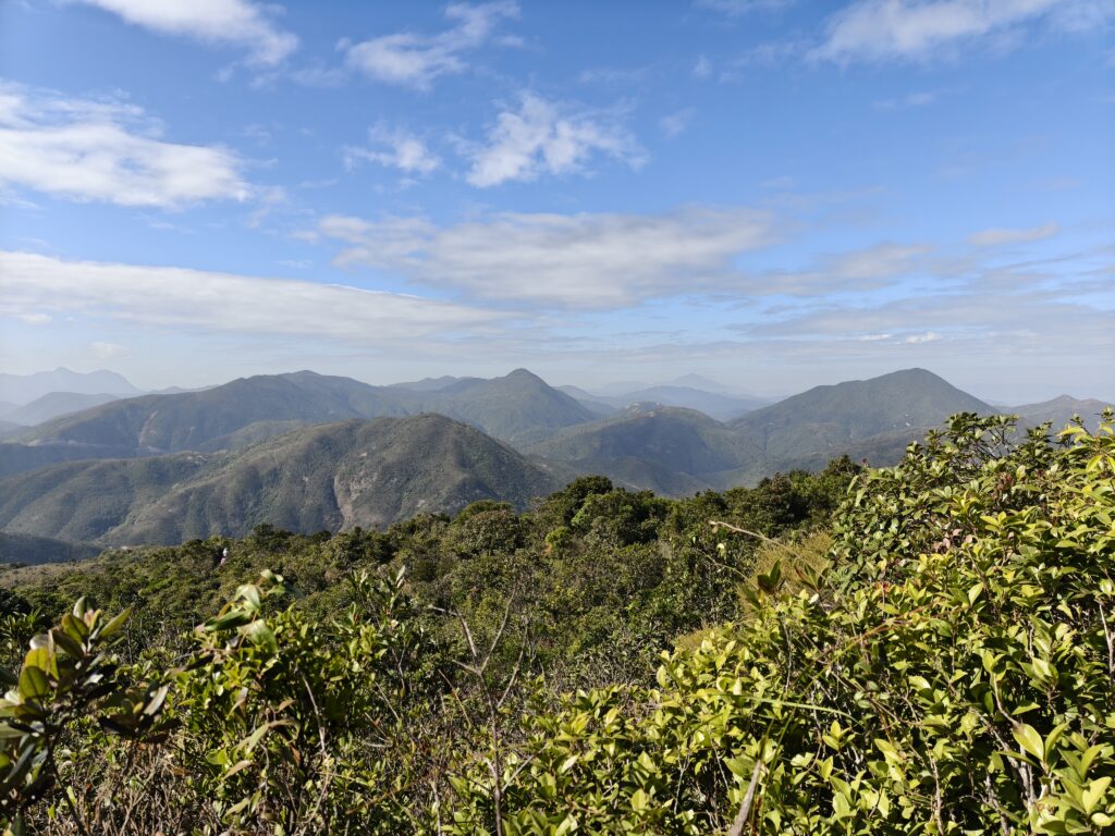
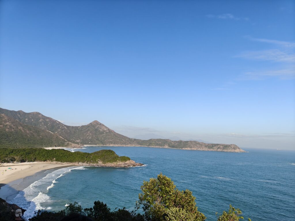
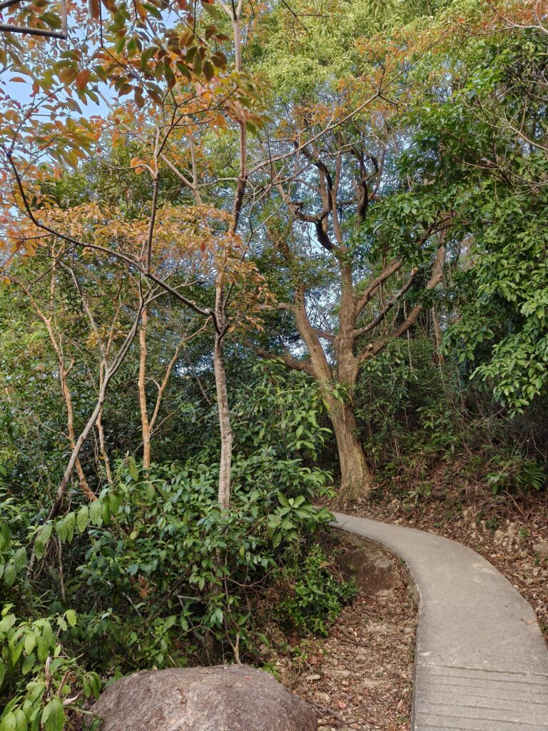
Basically, this hike had lots of ups (going up to peaks) and then downs (down to the beaches). This first peak was the most intense, but there were several other peaks as well. I won’t give you a play-by-play because I think some element of surprise is nice on hikes. If you feel that way, don’t look at all the pictures! But I will share many of my pictures because it was incredible.
I loved all the different types of scenery on this hike. We could enjoy lots of mountains around us. We could see some sharp peaks as well as some more gradual slopes. One mountain was apparently called Mosquito Peak. Haha, what a name!


I was really thankful when my back seemed to be doing ok, and for the first half of the hike, my knees were also doing well. If I don’t prepare well enough, my knees have quite a bit of pain during hikes. I did praise God for this.
As we hiked up the mountains, Jeff pointed out that hiking was kind of like our spiritual walk. As we grow in our faith, we can look back and see how much God has taught us and how far He has brought us. Then we look forward and see the challenges ahead. But pretty soon, God takes us through those challenges also. Then we look ahead and see even more challenges. There are almost always more challenges (even if that challenge is going down!), but God always helps us through, and He always gives us the strength for the next step. And looking back and seeing that low point is so encouraging as we think about how much God has helped us and walked with us.
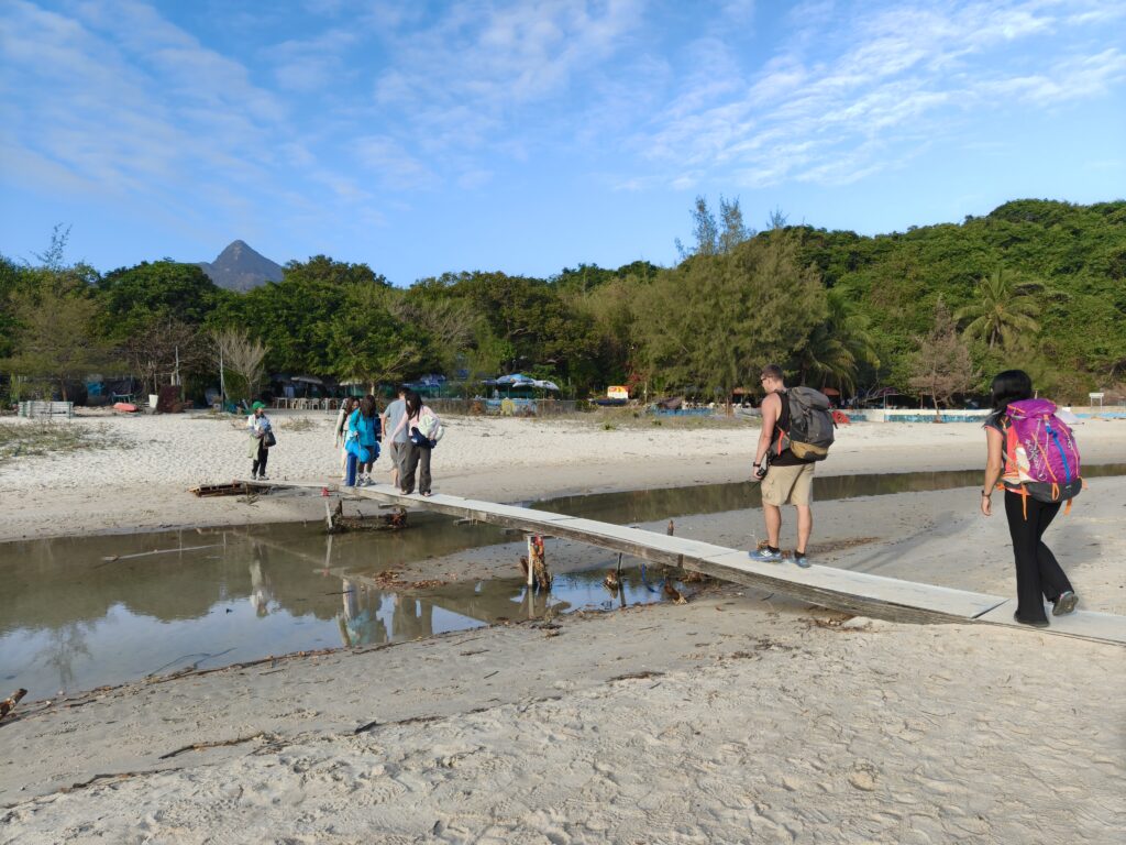
The pain started around 3 p.m. when we were on another downhill section. Thankfully we were nearly to the bottom, and we took it slow and rested a bit on the beach when we got there. Either this beach or the last one (or perhaps both) also had a little bathroom. (I was surprised by how many bathrooms there were, but since there were so many people, I was thankful that we didn’t have to try to find a tree. Some of the side areas were also quite dangerous—according to the signs, and it was nice to not have to leave the trail. My guess is that some of the brush disappeared quickly as it dropped off a cliff.)
I had to get pretty creative going down slopes, but thankfully there weren’t many stairs on the second half of the hike. Mostly I walked sideways or backwards, and I looked ridiculous, but I made it. Jeff graciously carried my bag for one of the downhill sections, but I didn’t notice a huge difference with or without the bag at this point.
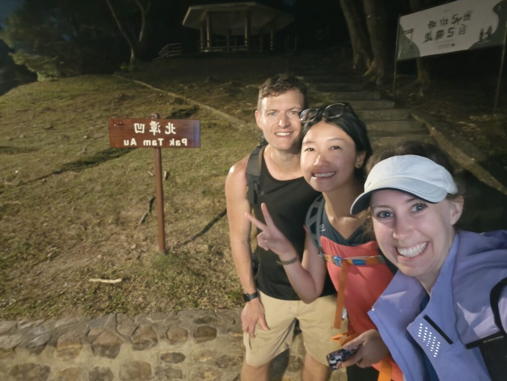
The tough point was when we passed the last beach at about 4:30 and as we were looking for the road. At this point, we started following signs for the destination 北潭凹(SK403)[公交站] or in Cantonese, Pak Tam Au. We saw a sign that pointed us in the right direction, but it said that we still had 2 ¼ hours to go! That would put us there after dark, and my knees were pretty sore at this point.
But we pressed forward. The way to do hard things is just one step at a time. We had some good talks, and I prayed that I would be able to get through. Thankfully the pain felt more like a muscle problem than a serious injury, but it was still a challenge.
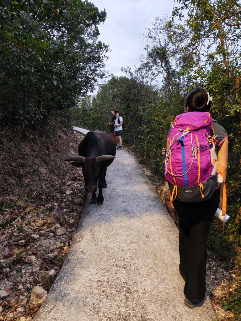
When we reached the boat docks, dusk was upon us, and I was ok with ending our hike. Someone said we could get a speedboat back to the city. I also thought the hike was basically done. But then we realized that there were still a couple more kilometers, and since we all kind of wanted to finish the whole section, we pressed forward. There were still a few other hikers, and they confirmed that we were going in the right direction, but most of them were faster than us. We did pass a cow who was going in the opposite direction, but I guess he didn’t have a bus to catch.
Last, let’s see what to do after the hike?
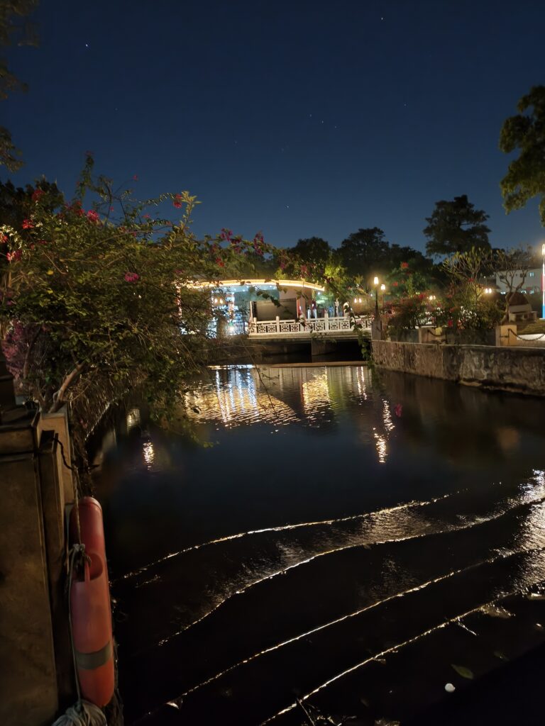
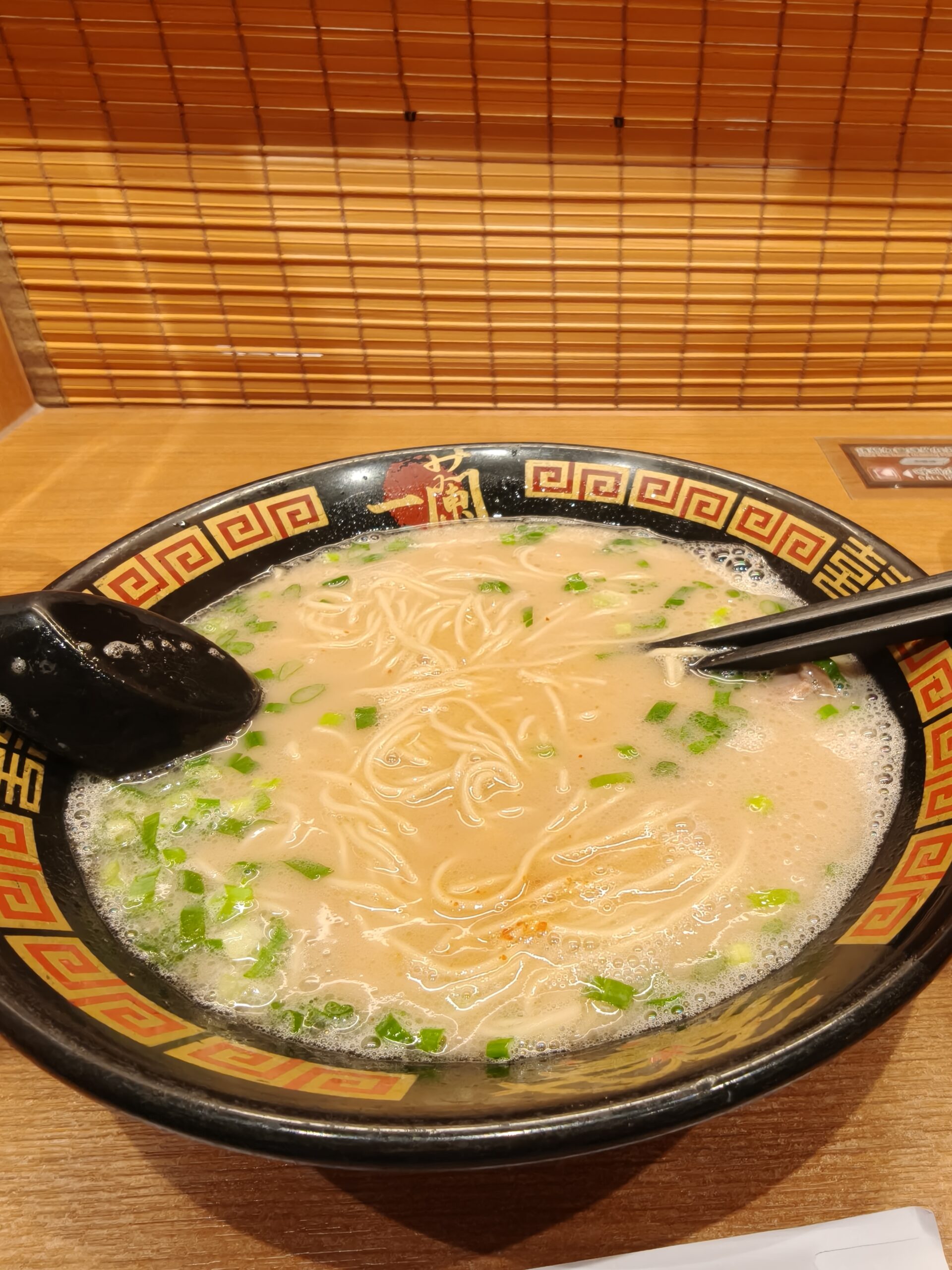
We finally arrived at our final destination, another bus stop. The end of the hike wasn’t that special to look at, but by this time, we were all happy to be done. And we could see the next section of the trail heading off down the road. Next time. We will meet again. We tried to get a taxi, but there were only green taxis, and they couldn’t go to our hotel–we would need a red taxi for that. We finally got a bus that would take us to the metro. On the bus, we could figure out our dinner plan. We wanted to go to a Japanese Ramen place called Ichiran that I really like in Hong Kong and one of the two branches was near our hotel.

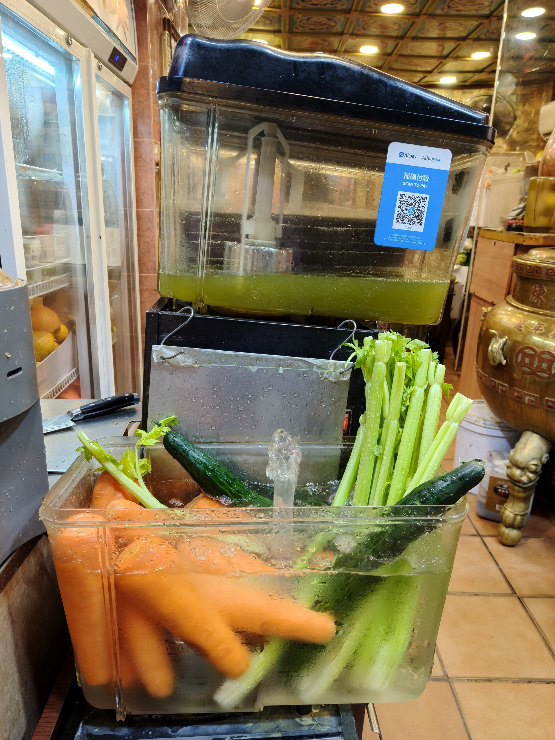
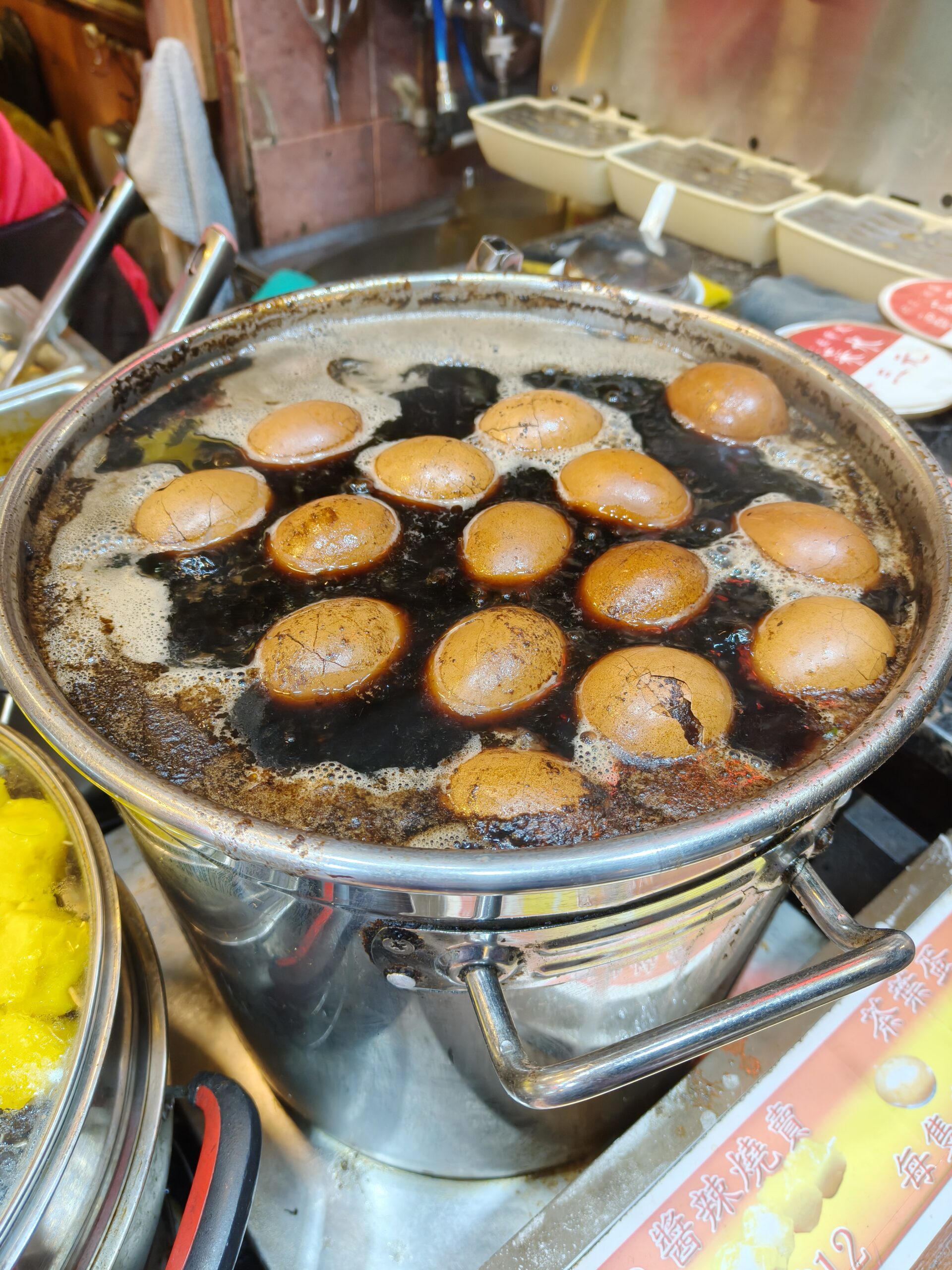
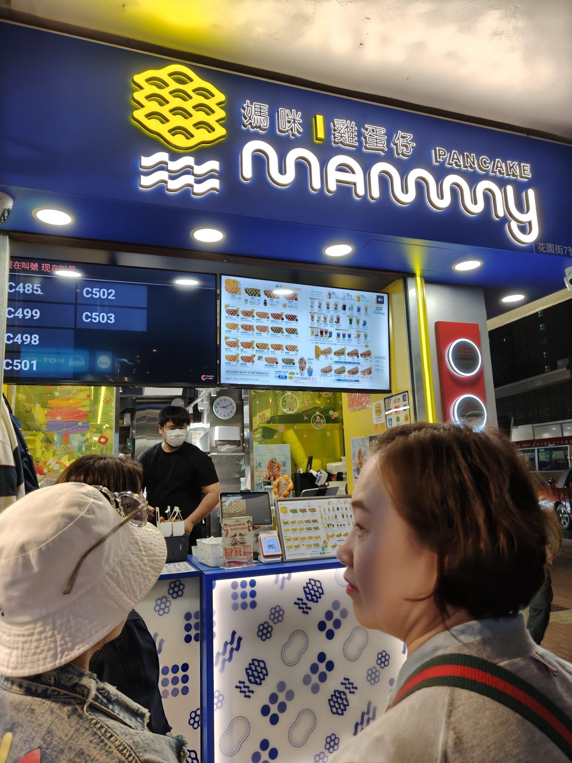
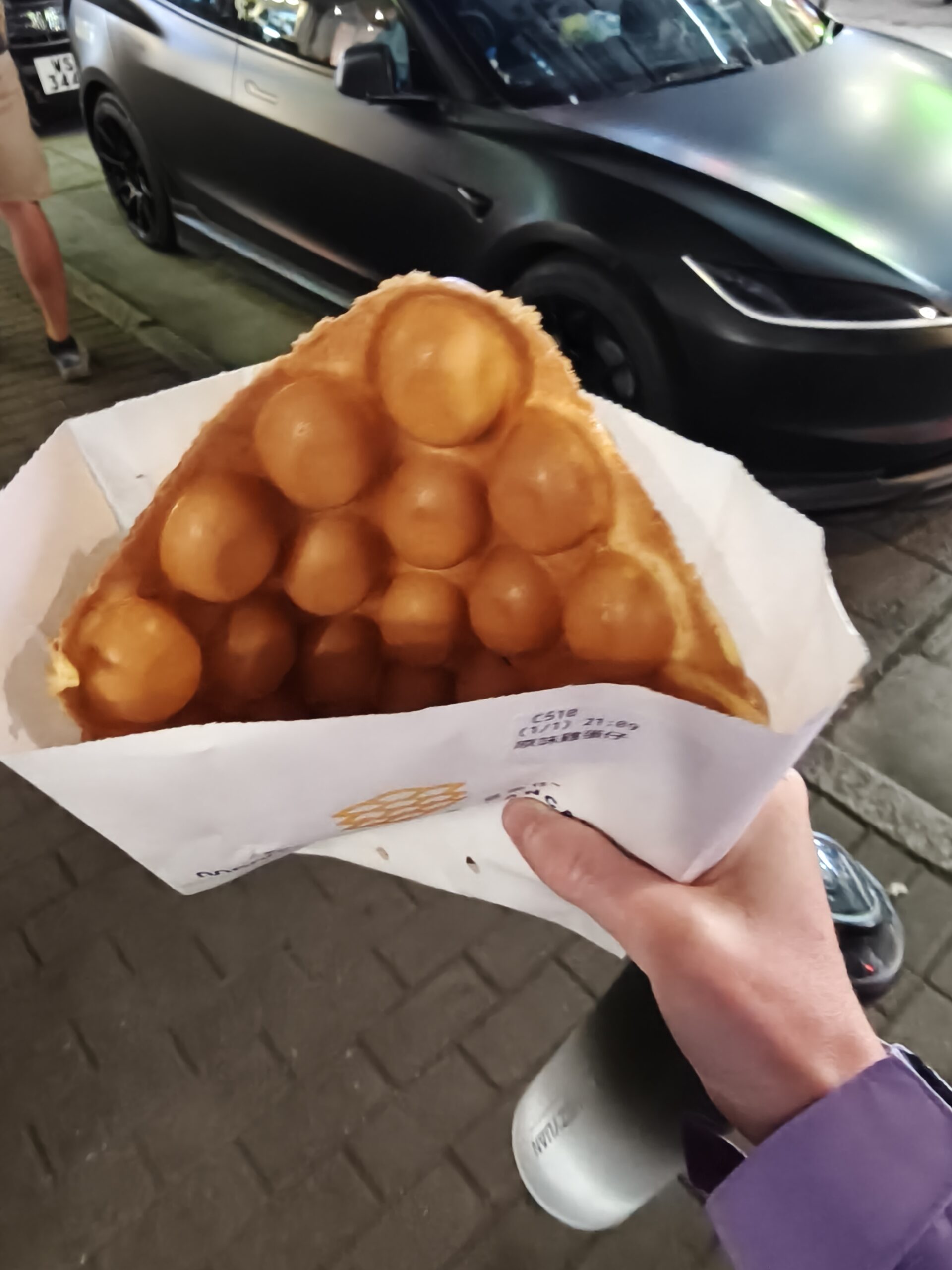
After getting off the bus, we got a taxi to the restaurant and got a number. Since the restaurant is super popular, we expected a bit of a wait, so we walked around and explored the area. There was lots of food in the area, and I was drooling over everything. We finally got a tea egg, but it was too hot to eat immediately. When it did cool off enough to eat, it was probably the best tea egg I’ve ever had. Hunger is a delicious ingredient. We finally got into the Japanese Ramen place and enjoyed some delicious noodles. But we were still hungry so we got a 鸡蛋仔 (Ji dan zai) also. These are another Canton specialty, and I enjoyed it thoroughly.
Since the hotel was nearby, we ended up walking, and since the ground was flat, it was bearable. According to true Hong Kong form, the hotel room was very tiny, but at this point, I was just excited to have a bed. So there’s the MacLehose Trail, section 2 for you! Hopefully I’ll be able to go for another section soon!
Love all the details, instructions, lessons learnt and the Amazing photos! God is good, all the time.
Amen! And thanks for the feedback!